
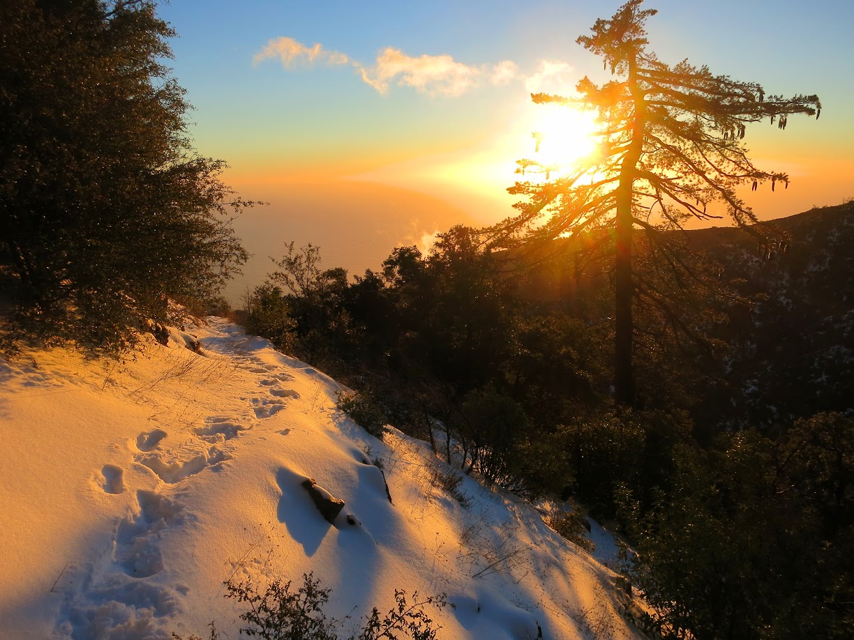
The “Snow Cone” is somewhat of a mythical event to experience. A snow on Cone Peak is not rare in itself, but rather the ability to experience and capture a fresh snow. Most years have snow on Cone Peak, and sometimes multiple times per year, but as I will describe, they are virtually always difficult to forecast more than a day in advance and the snow is fleeting and hard to capture. Timing is therefore very important to get the full winter wonderland effect (with trees and vegetation cloaked in snow) above the spectacular Big Sur coast. When it all comes together, standing in fresh snow while marveling at the turquoise and blue waters of the Pacific Ocean thousands of feet below indeed feels like something out of a dream or mythology! The challenges of timing a Snow Cone reminds me of growing up in the Seattle area wishing for lowland snow. As with the Snow Cone, there were many more teases than actual snow storms in the Seattle area, but when the ingredients came together it was always magical. In many ways, the forecasting challenges for lowland snow in Western Washington and Cone Peak are similar and I’m just as fascinated now as when I was young.


I’ve been captivated by the possibility of a Snow Cone for some time. I’d seen enough from others who’d witnessed past events to know that it was something special and an event that I wanted to experience for myself but I also knew that if timed correctly it could be that much more amazing. Along the way I’ve sought to understand what weather patterns might make for a good Snow Cone in order to be at the right place at the right time when an opportunity presents itself. The drought got in the way of my plans for a few years but I finally got the opportunity to implement some of this knowledge during Snow Cones on January 21st and January 24th. In particular, the snow on January 24th measured 15 inches on the summit with snow down to 2,500 feet, the most significant snow in many years. The winter wonderland we encountered even exceeded my dreams. The following is a discussion of some of the science behind what it takes to get a Snow Cone. Note that these are just the thoughts and observations of a weather enthusiast and I have no formal training in meteorology. Also please note that all photos are © Leor Pantilat, All Rights Reserved. Please request permission for any use.


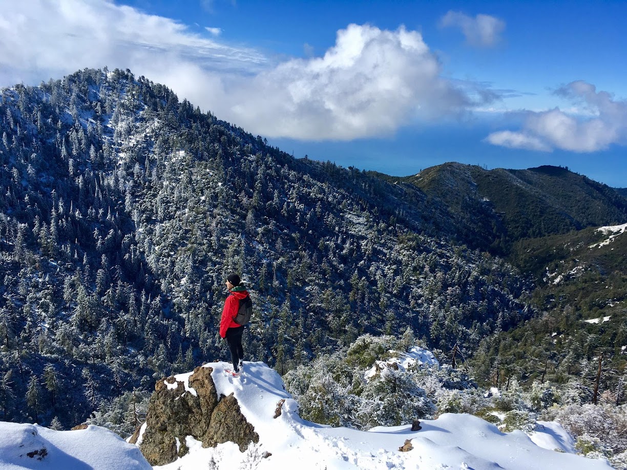
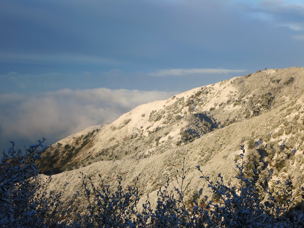
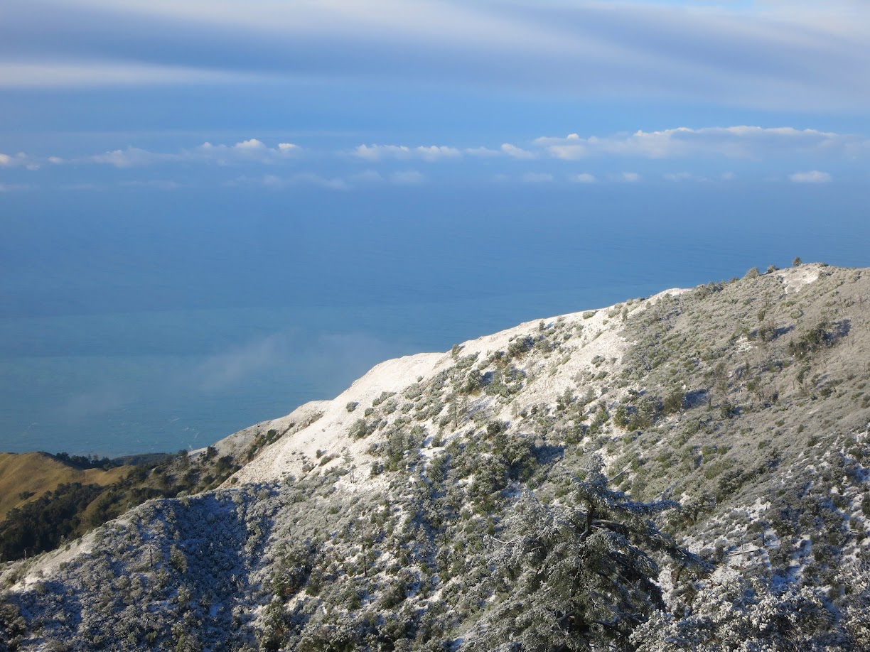
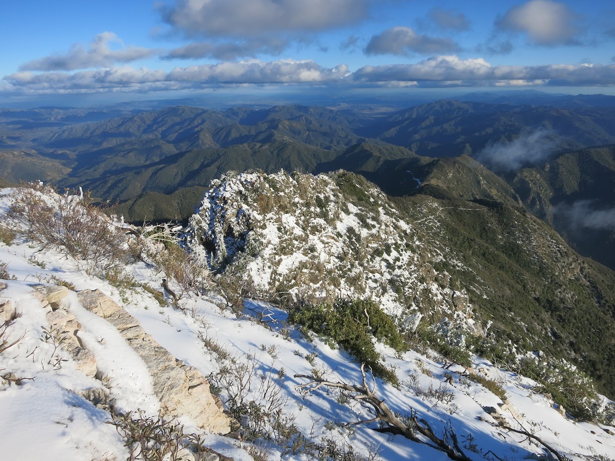
At 5,164 feet one might guess that the summit of Cone Peak receives quite a bit of snow, both in terms of number of events per year and aggregate number of inches. However, this is not the case since there are many counteracting factors that turn many promising snow events into merely teases. For a Snow Cone you need the ingredients – namely cold air and moisture – to come together just right. If you continue reading, you’ll see there are a number of moving parts that make it challenging to get these two ingredients together at the same time. Then, assuming a snow does happen, it’s sometimes a challenge to obtain the visibility of the coast from the summit. In my opinion, it’s not the same if the mountain is stuck in a cloud. What makes a snowfall on Cone Peak so unique is the ocean vistas and while certainly not a requirement of a Snow Cone, having visibility of the coast elevates the experience to another level.


Snow Cone is a fairly infrequent event. I’d estimate that a “normal” season probably sees a handful of times where the summit receives more than a dusting and one to two events in the 6-8 inch range on the summit. Any event that exceeds 8 inches on the summit or drops snow below 3,000 ft happens much less frequently and cannot be counted on every season. In fact, using the term “normal” may be somewhat of a misnomer considering California’s climate which swings wildly between drought and big winters. In fact, one of the winters in the recent drought likely did not even have one snow event the entire season. On the other hand, “big” winters with a persistent flow out of the Gulf of Alaska may see several good snow events. A snow Cone is possible as early as the end of November, but the season really only gets started in January with the best possibilities residing in January through mid March.


Any discussion of Snow Cone needs to start with geography. The summit of Cone Peak is only 3 miles from the coast making it the steepest gradient from ocean to summit in the contiguous United States. This topography is what makes Cone so special. However, since the mountain is essentially right over the ocean that is a problem for snow prospects. Even in January the ocean temperature is typically in the mid 50s. Water holds heat better than land does and it therefore warms the air above it. Thus, the Pacific Ocean has an enormous moderating effect on coastal temperatures. Right at the coast temperatures are very mild even in the heart of winter and also mild in the middle of summer with a persistent marine layer. With onshore flow out of the south or southwest, warmer maritime air envelops the summit and snow is out of the question.


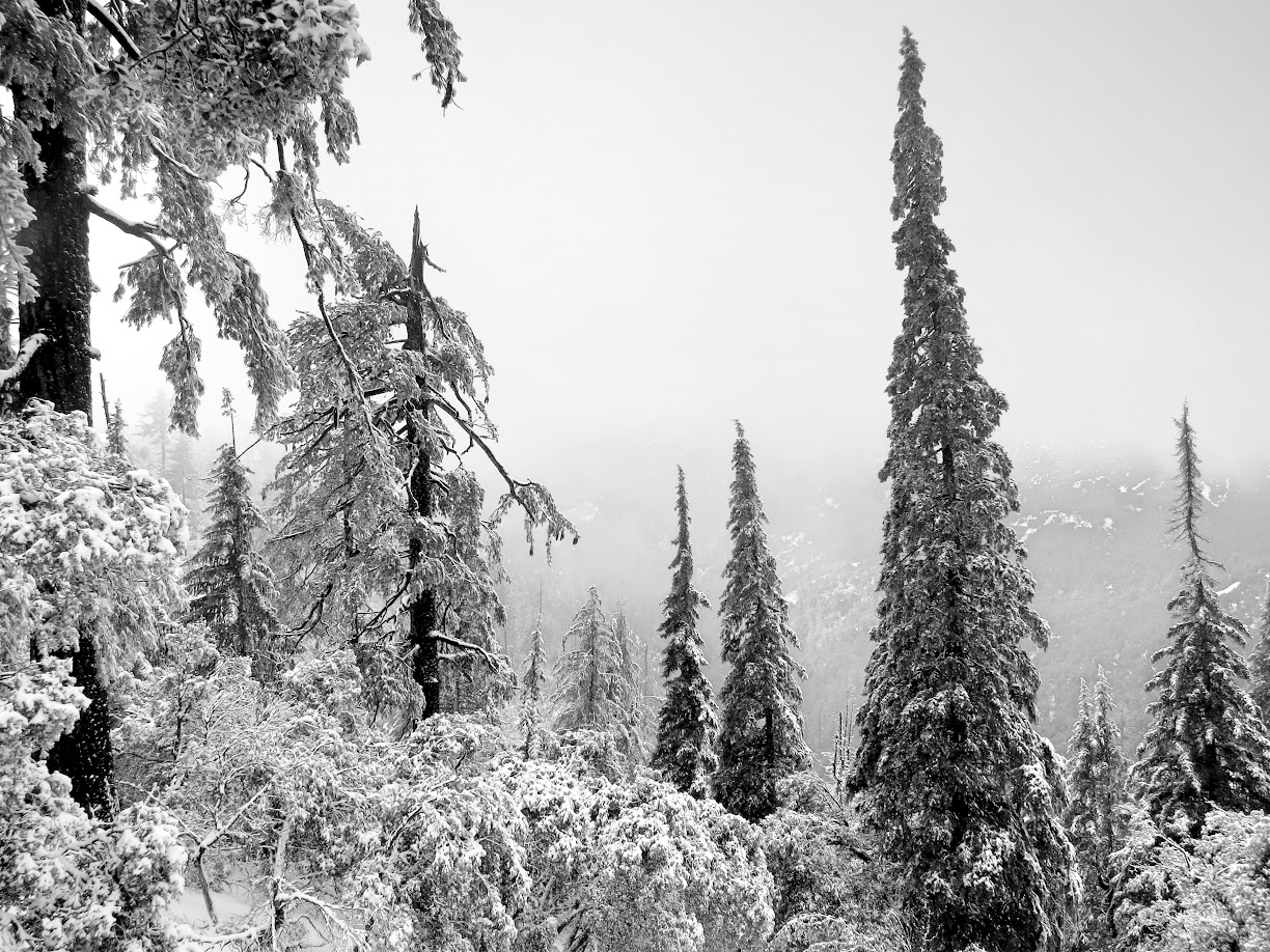
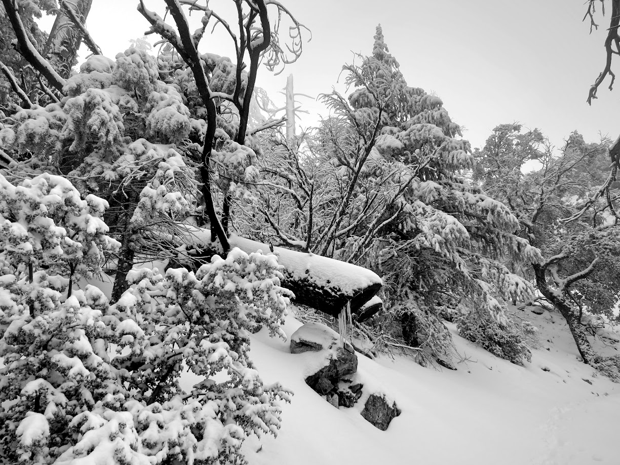
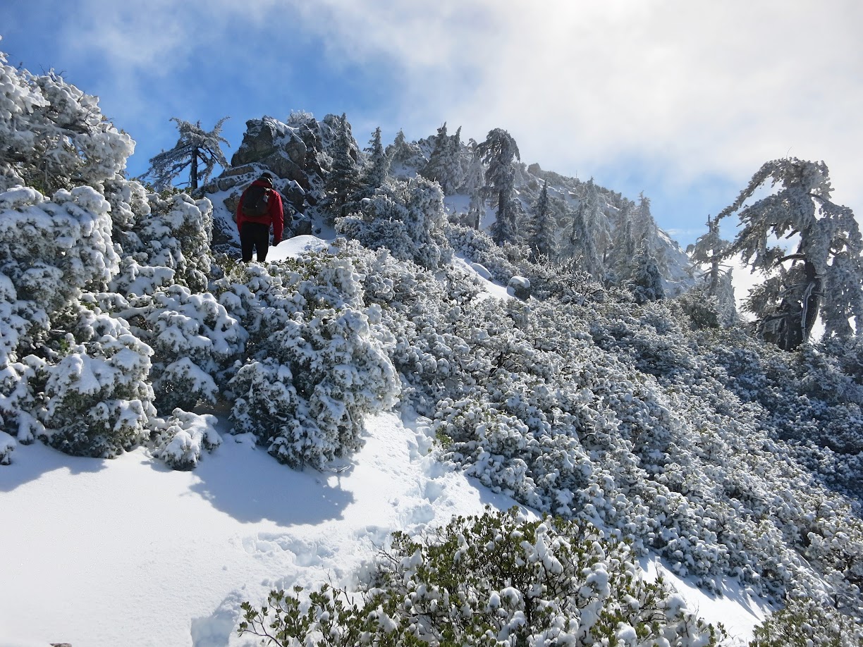
The next problem is that Cone Peak is not a naturally cold spot. Colder air from elsewhere is needed. Cone Peak resides at a relatively south latitude with a Mediterranean climate characterized by hot, dry summer and cool, wet winters. I would go so far as to say that most of the year is warm to hot on Cone, especially on its sun-baked south facing slopes. Even during the winter it’s rarely cold. Most of the precipitation that falls on Cone occurs during warmer “Atmospheric River” events that pull in copious moisture from the subtropics and raise snow levels well above the summit. The vast majority of snow events are “fringy” meaning that the temperature on the summit is just barely cold enough to snow. Even when it does snow, it is almost always very fleeting. Once the sun comes out it’s only a matter of hours before the south facing slopes melt out and the snow and ice drop from the trees and chaparral. With a big enough snow the north facing slopes will hold onto snow on the ground quite a bit longer, but the chaparral vegetation and trees will start dropping snow from their limbs as soon as the sun comes out and temperatures rise above freezing.


So how does it get cold enough to snow? The answer is usually not arctic air. It is very rare for continental arctic air masses originating in Canada to reach Cone Peak’s latitude on the central California coast. The path of least resistance for these air masses is east of the Rocky Mountains, but even when the cold air manages to sneak through the Rockies, it still has to get over the Cascades and the Sierra Nevada. That means there are several barriers impeding the progress of these cold air masses. Due to these challenges, I’d estimate that a modified arctic front only reaches Cone Peak once every five years or so. When these fronts do reach central California the next problem is moisture. These systems tend take an inland trajectory more often than not which usually means they are moisture starved. The northern end of the Santa Lucias can be efficient at squeezing out snow in these scenarios, but Cone lies in an unfavorable “snow shadowed” position in this situation. When the already-rare arctic front happens to swing off the Northern California coast and gather moisture off the Pacific, this becomes the textbook setup for low elevation snowfalls in coastal California. However, there’s a reason snow is so rare in San Francisco and Monterey. That’s because arctic fronts are rare as-is and then to have them swing offshore just enough to gather moisture (but not too much to warm the air up) is even more rare. Despite the rarity, history has been marked with just this sort of event many times, and it seemingly happened more in the past with several records of measurable snow in downtown San Francisco in the late 1800s, 1951 and 1976 from just this sort of pattern. While it’s been 40 years since this pattern came together just right to produce snow in San Francisco, arctic fronts are always something to watch for and the December 2008 snow was associated with an arctic front. That said, arctic fronts do not happen frequently enough to be considered the primary producer of a Snow Cone.


So if it’s not from the arctic where do the ingredients for a Snow Cone usually come from? The answer is the Gulf of Alaska. These systems tend to be much more reliable in the moisture department as they take an over-water trajectory. They also tend to occur with much greater frequency in a normal winter (the drought years were a notable exception when it seemed like years passed without a strong Gulf of Alaska storm). However, with Gulf of Alaska systems, since the cold air is of maritime origins it’s usually more cool rather than cold. In most cases this takes lowest elevation snow out of the equation, but the snowline with these systems is more nuanced as a strong enough Gulf of Alaska system with a low pressure tracking to just the right spot can lower the snow level to 2,500 feet or even lower.


Gulf of Alaska systems come in many flavors that have consequences on snow possibilities. These systems typically include a cold front moving down the coast which will draw up warmer air ahead of the front from the south and southwest. Most of the heavier precipitation usually resides ahead the frontal band and, frustratingly, it’s going to be too warm in this sector of the storm. Once the frontal band passes the wind direction turns to northwesterly and this allows the cooler air out of the Gulf of Alaska to filter in. Within this cool, unstable air resides cumulus and showers. If this transition to cooler air is prompt, then these showers can start producing snowfall over the summit soon after frontal passage. It helps if there has been preceding systems already establishing cool air over the region so the warm sector of the system is brief. If the cooler air takes its time to arrive it’s likely not a good sign for a Snow Cone. Once the front passes and the cooler air has arrived attention turns to the “shower game” which can be equally frustrating. Not all Gulf of Alaska systems have a deep reservoir of showers after the front passes. Many times there isn’t enough moisture in the post-frontal airmass to produce more than hit and miss showers once the cool air has arrived. Other times the trajectory of the shower flow is out of the northwest which is a great setup for the northern Santa Lucias like Ventana Double Cone and Chews Ridge, but once again Cone Peak is “snow shadowed” by these peaks to its north. For post-frontal showers to be successful for Cone Peak the flow of showers needs to be more from the west and it needs to be fairly strong with a lot of post-frontal shower activity.


After the frontal band passes things get more interesting when discussing the track of the low pressure. Most times the parent low will track north into the Pacific Northwest but sometimes with a deep and digging trough over the western United States the low will descend into the base of the trough by sliding down the coast and moving inland over Big Sur or to the south. The low serves as a mechanism to organize shower activity and produce heavier snowfall and is entirely within the cold part of the system. The success of this type of setup is highly sensitive to the track of the low. A track too far north may draw up warmer from the south and southwest and raise snow levels too high. A track too far south or offshore will take away the moisture to make snow. Thus, a track that either closely parallels the coast or comes in just to the south is likely ideal. This Goldilocks setup does not happen very often but when it does you can get lower elevation snowfall and heavier snow totals up top.


In late winter and early spring instead of frontal bands coming out of the Gulf of Alaska, the systems sometimes take on the form of a cutoff low, which is a low that has been cutoff from the basic westerly flow. Instead of a widespread precipitation event with a well-defined frontal band, these cutoff lows can sit off the coast quasi-stationary for a day or longer and spin up showers. It can be quite cold underneath these lows and if they are positioned correctly they can result in substantial snow over Cone Peak along with hail and thunderstorms at lower elevations. In fact, these cutoff lows are responsible for many of the late season snows in March and April. Since the cold air is typically confined to right underneath the low, once the low does “eject” the temperatures usually warm up rapidly.


The final type of Snow Cone doesn’t originate in the Gulf of Alaska or the arctic. Sometimes systems will come directly out of the west with a low making landfall somewhere on the central coast. As Cone Peak is on the cooler north side of such a system and the air flow can become weakly offshore (cutting off the moderating influence of the Pacific) the air can be marginally cold enough for a higher elevation snow event (generally above 4k) and possibly lower if there is some antecedent cooler air in place.


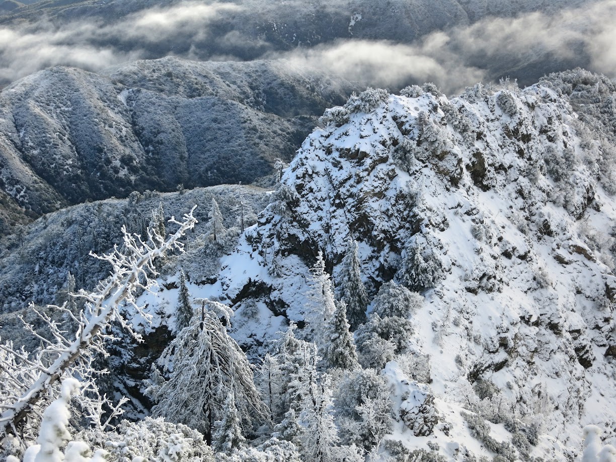
If all of the ingredients line up correctly then Cone can be an efficient snow producer and create a unique and magical winter wonderland. In a matter of hours 6-8+ inches can accumulate. The northwest facing Devils Canyon is masterful at orographically enhancing precipitation and generating clouds. If it’s below freezing and the mountain is in a cloud rime ice begins to build up on vegetation within these clouds despite the fact that there are no higher based clouds and precipitation. After several hours the ice can accumulate to impressive amounts, particularly on the very exposed ridge lines, as manifested by an event on January 21st that produced 2-3 inches of ice accumulation.


Let’s assume the ingredients came together and a snowfall happened. The next problem is visibility and whether there will be any. Being so close to the moist environment of the Pacific Ocean, it’s often a difficult task to clear the mountain of clouds. Even if the mountain is clear in the morning, cumulus development in the afternoon is a good bet if a substantial snow has occurred and onshore flow persists. On some occasions a dry northerly wind will follow a snow and blow away all the clouds, but these winds might also blow the snow off the vegetation. Other times the mountain is socked in for the entire day after a snow. For me personally, what makes a Snow Cone so special is the proximity to the ocean and having the visibility to the ocean takes it to another level. Thus, not only is timing the snow important, but also timing the breakout from the clouds!


The January 24th snow event produced 15 inches of snow on the summit of Cone Peak with spots along the north ridge approaching 2 feet. These totals are significant and have not been seen in several years (likely back to 2011 or 2008). This was a classic Gulf of Alaska storm that was the the final system of three. The preceding two systems served to progressively cool the atmosphere. In fact, it was already cold enough to produce 2-3 inches of rime rice and 4+ inches of snow with the second storm on January 21st. On Saturday evening, January 21st, the frontal band with third storm approached but precipitation fell as rain in the pre-frontal band with strong onshore flow out of the south and southwest drawing up warmer air. However, temps on the summit only rose into the mid 30s as the warm sector was brief and once the front passed early Sunday morning it did not take much to lower the snowline back below the summit. In addition, the post-frontal shower game with this third system was especially strong. There would be a constant stream of moisture flowing into the Santa Lucias in the cold and unstable environment. The topography of Cone Peak would only serve to enhance these showers and since the showers were coming out of the west the mountain would not be “snow shadowed” by peaks to the north. 


Wow! We’ve had some awesome conditions lately east of the Sierra, but this makes me very jealous. Amazing images!
Thanks Jackson!
Great report, pictures, and video! One question i hope you can help with: What foot gear do you use for snow? Gore-tex shoes or just regular trail running shoes or something else? I’ve been doing some snow runs in SoCal and have been struggling with choosing between potentially wet, cold feet and warm but un-runnable boots. Thanks in advance.
Thanks Steve! Great question. I use the La Sportiva Crossover 2.0 GTX and it’s amazing in wet or snowy conditions. I’ve used it running through slush puddles and snowshoeing through deep snow and my feet stay dry. The Gore-tex keeps the wet out of the front and the integrated gaiter keeps the snow from coming over the top (which inevitably melts once inside). Its also got a great lug pattern for grip on snow and ice. The shoe is also very runnable. http://www.sportiva.com/men-s/men-s-footwear/crossover-20-gtx.html
Thanks Leor, that’s super helpful! I’ll definitely check those out.
Thanks for sharing this amazing adventure with us! Absolutely stunning photos that rivals your waterfall series.
Thanks Stan!
magical and fascinating. Thanks!
Great images and explanation! I love your posts.
Excuse my French: “This is Fu*king awesome!” A rare footage on Cone Peak with fresh powder. Didn’t you wish you had a pair of skis? Thanks for sharing, Leor.
Hi Leor,
We just drove down the 1 past Cone peak (4/9/18) and noticed what looked like snow on the peak, which lead to finding your blog. Maybe you can settle this debate we’re having… Is snow still on the peak this late? Thanks!