
At 48+ miles, the High Sierra Camps Loop covers a lot of ground and in the process showcases the spectacular Tuolumne Meadows area and Yosemite high country. The route includes a great mix of scenery characteristic of the region including lakes, waterfalls, meadows, granite and views. It’s one of the most popular circuits in all of the Sierra Nevada, largely owing to six conveniently spaced wilderness accommodations along the route. These fully-stoked camps allow patrons to travel without the burden of an overnight backpack and eat cooked meals every night and morning; a relaxing way to enjoy the scenery for some. A couple weeks ago I hiked and jogged the High Sierra Camps Loop as a day-trip and I included a few worthwhile side excursions that I had scoped out before. I intentionally aimed to do this loop before the camps opened for the summer so crowds were minimal. Strava route here. Following are photos and a video from the outing, a beautiful late spring day in Yosemite!

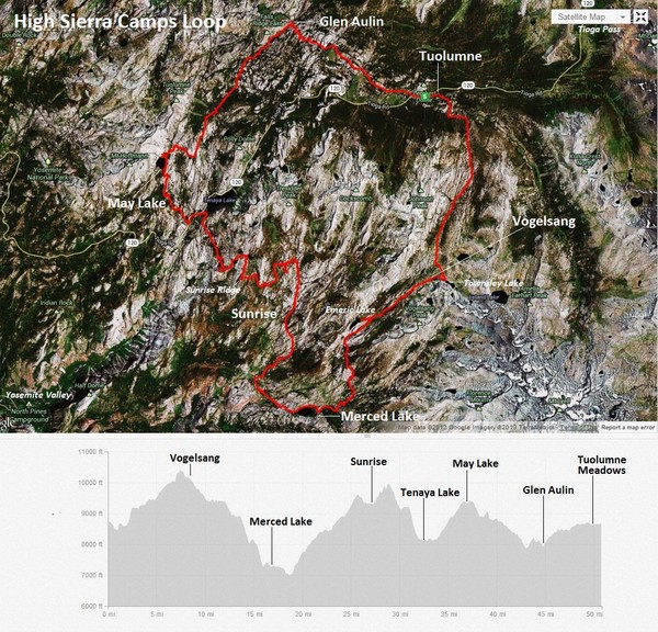
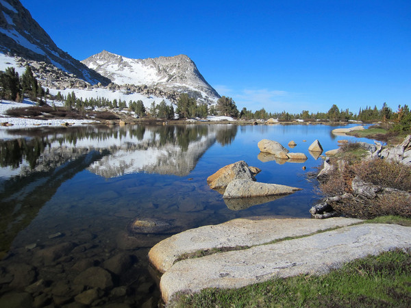
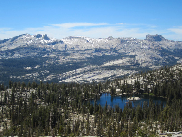
Save for a few miles between May Lake and Glen Aulin, there is virtually always new scenery around the corner to inspire and motivate. There are numerous variations of the base route and several worthwhile side trips that provide a lot of bang for the buck in terms of effort to reward payoff. These side excursions include gorgeous Townsley Lake below the rocky buttresses of Fletcher Peak (near Vogelsang Camp), pristine Emeric Lake situated in a grassy meadow with a backdrop of granite cliffs (between Vogelsang and Merced), and Sunrise Ridge with 360 degree views including the Cathedral Range and Tenaya Canyon (near Sunrise Camp). A great summit near the route is the popular Vogelsang Peak with close views of the “roof of Yosemite” – Mount Lyell, Mount Maclure and Mount Florence. One can continue to Vogelsang Pass and descend Lewis Creek to Merced Lake instead of the standard route along Fletcher Creek. Another summit near the route is Mount Hoffman, geographically at the center of Yosemite with great panoramic vistas. Maximum elevation for the standard 48-49 mile route is just over 10,000 feet so altitude is largely not an issue. Moreover, the low point at Echo Valley is only around 7,000 feet so elevation change is not daunting. The greatest climbing is into and out of Echo Valley/Merced Lake. While it’s fairly gradual in nature, this portion can be quite hot owing to it’s exposed nature. Furthermore, the trail descending from Fletcher Creek to Merced Lake is a “cobblestone” path of uneven rocks so it’s an arduous and technical section if you’re trying to run downhill. Overall, the High Sierra Camps Loop is a great route, both for multi-day backpacks and for single-day trail runs. I would definitely consider checking out some of the attractions off the beaten path, which are relatively close but are real gems.


Clouds are awesome. I’m doing that next year. Great summary Leor.
Wonderful! How long did it take you to complete the loop?
Love that, Leor! I’ve done the first half of it from Tuolumne to Merced Lake, but you really stretched the distance! What sort of backpack and food did you have? Did you just filter water?
Reblogged this on Paradise Springs and commented:
Simply gorgeous!
Pretty nice post. I just stumbled upon your blog and wished to say
that I’ve truly enjoyed surfing around your blog posts. In any case I’ll be subscribing to your
rss feed and I hope you write again soon!
Hello, wonderful blog. I would like to use one of your images on my blog. I will properly attribute of course.
Hi Leor, great summary of the loop. I did it 30 years and am lucky enough to do,it again this summer. You photos are really great. What camera did you use? I usually carry a large Canon but in the market for something smaller. Thank you so much! Aloha, Diane